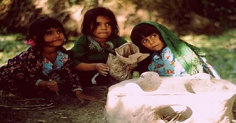
Kashmir (Kashmiri: كشهير kaśhīr, Ur.du, Shina: کشمیر kaśmīr, कश्मीर, Hindi) is a geographical region in the north-west of the Indian subcontinent. Until the mid-19th century, the term Kashmir geographically denoted only the valley between the Great Himalayas and the Pir Panjal mountain range.
Today, it denotes a larger area that includes the Indian administered territories of Jammu and Kashmir (which consists of Jammu, the Kashmir Valley, and Ladakh), the Pakistan administered territories of Azad Kashmir and Gilgit–Baltistan, and the Chinese-administered regions of Aksai Chin and the Trans-Karakoram Tract.

Since medieval times, Kashmir has been an important centre for the development of a Buddhist-Hinduist syncretism, in which Madhyamaka and Yogara were blended with Saivism and Advaita Vedanta.
The Buddhist Mauryan emperor Ashoka is often credited with having founded the old capital of Kashmir, Shrinagari, now ruins on the outskirts of modern Srinagar. Kashmir was long to be a stronghold of Buddhism.
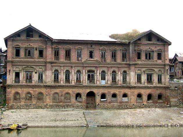
As a Buddhist seat of learning, the Sarvāstivādan school strongly influenced Kashmir. East and Central Asian Buddhist monks are recorded as having visited the kingdom. In the late 4th century CE, the famous Kuchanese monk Kumārajīva, born to an Indian noble family, studied Dīrghāgama and Madhyāgama in Kashmir under Bandhudatta.
He later became a prolific translator who helped take Buddhism to China. His mother Jīva is thought to have retired to Kashmir. Vimalākṣa, a Sarvāstivādan Buddhist monk, travelled from Kashmir to Kucha and there instructed Kumārajīva in the Vinayapiṭaka.
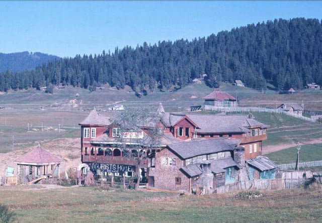
According to tradition, Adi Shankara visited the pre-existing Sarvajñapīṭha (Sharada Peeth) in Kashmir in the late 8th century or early 9th century CE. The Madhaviya Shankaravijayam states this temple had four doors for scholars from the four cardinal directions. The southern door (representing South India) had never been opened, indicating that no scholar from South India had entered the Sarvajna Pitha.
According to tradition, Adi Shankara opened the southern door by defeating in debate all the scholars there in all the various scholastic disciplines such as Mimamsa, Vedanta and other branches of Hindu philosophy; he ascended the throne of Transcendent wisdom of that temple.

Abhinavagupta (c. 950–1020 CE) was one of India’s greatest philosophers, mystics and aestheticians. He was also considered an important musician, poet, dramatist, exeget, theologian, and logician – a polymathic personality who exercised strong influences on Indian culture. He was born in the Kashmir Valley in a family of scholars and mystics and studied all the schools of philosophy and art of his time under the guidance of as many as fifteen (or more) teachers and gurus.
In his long life, he completed over 35 works, the largest and most famous of which is Tantrāloka, an encyclopaedic treatise on all the philosophical and practical aspects of Trika and Kaula (known today as Kashmir Shaivism). Another one of his very important contributions was in the field of philosophy of aesthetics with his famous Abhinavabhāratī commentary of Nāṭyaśāstra of Bharata Muni.
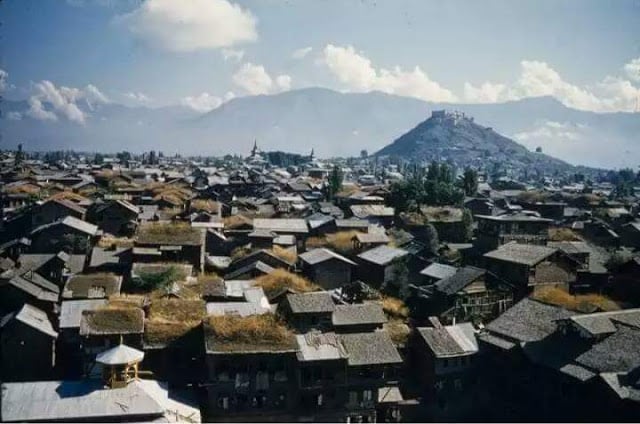
In the 10th century Moksopaya or Moksopaya Shastra, a philosophical text on salvation for non-ascetics (moksa-upaya: ‘means to release’), was written on the Pradyumna hill in Śrīnagar. It has the form of a public sermon and claims human authorship and contains about 30,000 shloka’s (making it longer than the Ramayana).
The main part of the text forms a dialogue between Vasistha and Rama, interchanged with numerous short stories and anecdotes to illustrate the content. This text was later (11th to the 14th century CE) expanded and vedanticised, which resulted in the Yoga Vasistha.

Shams-ud-Din Shah Mir (reigned 1339–42) was a ruler of Kashmir and the founder of the Shah Miri dynasty named after him. Sams’d-Din (ruled 1339-1342) also Dhams-ud-din and Shah Mir, was the first Muslim ruler of Kashmir and founder of the Shah Mir Dynasty.
Jonaraja, in his Dvitīyā Rājataraṅginī mentioned him as Sahamera. He came from Sawat according to some sources. However, Jonaraja a credible historian informs us that Shahmir was not from Swat so some historians say he was not from Swat but was a Kshatriya descended from Arjuna whose ancestors had taken up Islam.
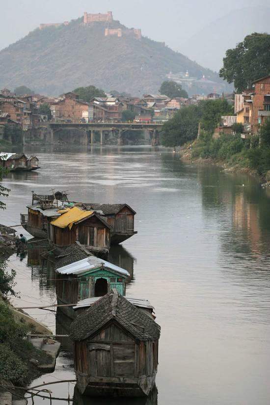
Shah Mir arrived in Kashmir in 1313 along with his family, during the reign of Suhadeva (1301-1320), whose service he entered. In subsequent years, through his tact and ability, Shah Mir rose to prominence and became one of the most important personalities of his time.
Later after the death in 1338 of Udayanadeva, the brother of Suhedeva he was able to assume the kingship himself, Rinchan (d. 1323), a commander from Ladakh region who had entered Kashmir as a fugitive seized the throne of Kashmir, started his personal quest for religion, was not accepted into Hinduism by the Brahmins due to his race, happened to watch Sayyid Bilal (d.1327) at prayer, was enchanted by the simplicity of the Sayyid’s faith and embraced it with fervour.

Rinchan from Ladakh and Lankar Chak from Dard territory near Gilgit came to Kashmir and played a notable role in the subsequent political history of the valley. All the three men were granted Jagirs by King Rinchan for three years and became the ruler of Kashmir, Shah Mir was the first ruler of the Shah Mir dynasty, which had established in 1339.
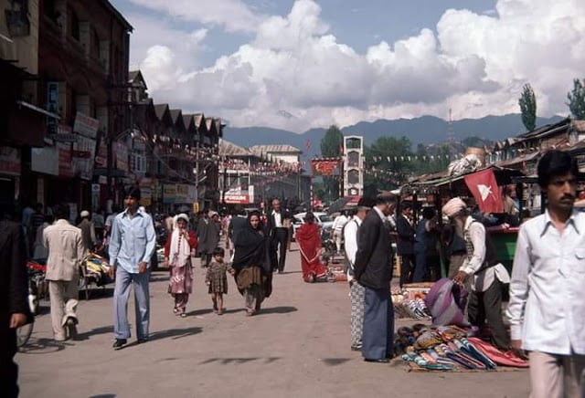
In 1819, the Kashmir valley passed from the control of the Durrani Empire of Afghanistan, and four centuries of Muslim rule under the Mughals and the Afghans, to the conquering armies of the Sikhs under Ranjit Singh of Lahore.
As the Kashmiris had suffered under the Afghans, they initially welcomed the new Sikh rulers. However, the Sikh governors turned out to be hard taskmasters, and Sikh rule was generally considered oppressive, protected perhaps by the remoteness of Kashmir from the capital of the Sikh Empire in Lahore.
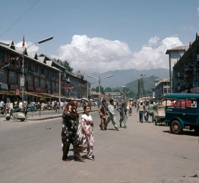
The Sikhs enacted a number of anti-Muslim laws, which included handing out death sentences for cow slaughter, closing down the Jamia Masjid in Srinagar, and banning the Azaan, the public Muslim call to prayer.
Kashmir had also now begun to attract European visitors, several of whom wrote of the abject poverty of the vast Muslim peasantry and of the exorbitant taxes under the Sikhs. High taxes, according to some contemporary accounts, had depopulated large tracts of the countryside, allowing only one-sixteenth of the cultivable land to be cultivated.

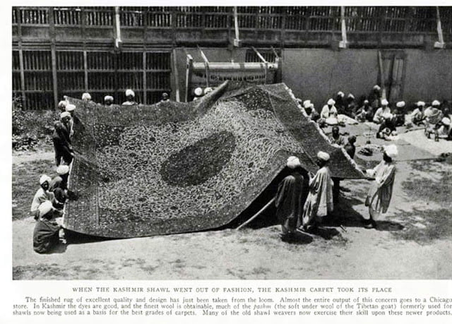
However, after a famine in 1832, the Sikhs reduced the land tax to half the produce of the land and also began to offer interest-free loans to farmers; Kashmir became the second-highest revenue earner for the Sikh empire. During this time Kashmiri shawls became known worldwide, attracting many buyers, especially in the West.
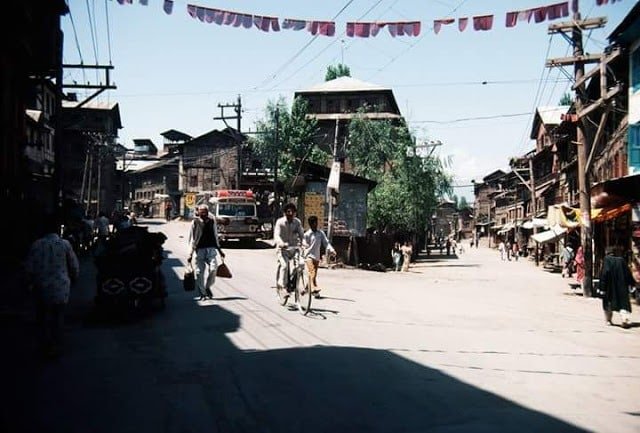
Earlier, in 1780, after the death of Ranjit Deo, the Raja of Jammu, the kingdom of Jammu (to the south of the Kashmir valley) was also captured by the Sikhs and afterwards, until 1846, became a tributary to Sikh power.
Ranjit Deo’s grandnephew, Gulab Singh, subsequently sought service at the court of Ranjit Singh, distinguished himself in later campaigns, especially the annexation of the Kashmir valley, and, for his services, was appointed governor of Jammu in 1820. With the help of his officer, Zorawar Singh, Gulab Singh soon captured for the Sikhs the lands of Ladakh and Baltistan to the east and northeast, respectively, of Jammu.
In 1845, the First Anglo-Sikh War broke out. According to the Imperial Gazetteer of India,
“Gulab Singh contrived to hold himself aloof till the battle of Sobraon (1846) when he appeared as a useful mediator and the trusted adviser of Sir Henry Lawrence. Two treaties were concluded. By the first the State of Lahore (i.e. West Punjab) handed over to the British, as equivalent to one crore indemnity, the hill countries between the rivers Beas and Indus; by the second the British made over to Gulab Singh for 7.5 million all the hilly or mountainous country situated to the east of the Indus and the west of the Ravi (i.e. the Vale of Kashmir).”
Drafted by a treaty and a bill of sale, and constituted between 1820 and 1858, the Princely State of Kashmir and Jammu (as it was first called) combined disparate regions, religions, and ethnicities: to the east, Ladakh was ethnically and culturally Tibetan and its inhabitants practised Buddhism; to the south, Jammu had a mixed population of Hindus, Muslims and Sikhs; in the heavily populated central Kashmir valley, the population was overwhelmingly Sunni Muslim, however, there was also a small but influential Hindu minority, the Kashmiri brahmins or pandits; to the northeast, sparsely populated Baltistan had a population ethnically related to Ladakh, but which practised Shi’a Islam; to the north, also sparsely populated, Gilgit Agency, was an area of diverse, mostly Shi’a groups; and, to the west, Punch was Muslim, but of a different ethnicity than the Kashmir valley.
After the Indian Rebellion of 1857, in which Kashmir sided with the British, and the subsequent assumption of direct rule by Great Britain, the princely state of Kashmir came under the suzerainty of the British Crown.

In the British census of India of 1941, Kashmir registered a Muslim majority population of 77%, a Hindu population of 20% and a sparse population of Buddhists and Sikhs comprising the remaining 3%. That same year, Prem Nath Bazaz, a Kashmiri Pandit journalist wrote: “The poverty of the Muslim masses is appalling. … Most are landless labourers, working as serfs for absentee [Hindu] landlords … Almost the whole brunt of official corruption is borne by the Muslim masses.”
For almost a century until the census, a small Hindu elite had ruled over a vast and impoverished Muslim peasantry. Driven into docility by chronic indebtedness to landlords and moneylenders, having no education besides, nor awareness of rights, the Muslim peasants had no political representation until the 1930s.

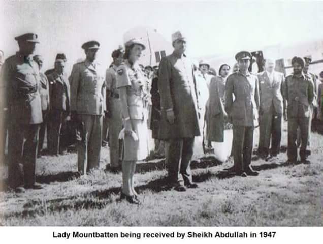
Ranbir Singh’s grandson Hari Singh, who had ascended the throne of Kashmir in 1925, was the reigning monarch in 1947 at the conclusion of British rule of the subcontinent and the subsequent partition of the British Indian Empire into the newly independent Union of India and the Dominion of Pakistan.
According to Burton Stein’s History of India, “Kashmir was neither as large nor as old an independent state as Hyderabad; it had been created rather off-handedly by the British after the first defeat of the Sikhs in 1846, as a reward to a former official who had sided with the British. The Himalayan kingdom was connected to India through a district of Punjab, but its population was 77 per cent Muslim and it shared a boundary with Pakistan. Hence, it was anticipated that the maharaja would accede to Pakistan when the British paramountcy ended on 14–15 August. When he hesitated to do this, Pakistan launched a guerrilla onslaught meant to frighten its ruler into submission. Instead, the Maharaja appealed to Mountbatten for assistance, and the governor-general agreed on the condition that the ruler accedes to India. Indian soldiers entered Kashmir and drove the Pakistani-sponsored irregulars from all but a small section of the state. The United Nations was then invited to mediate the quarrel. The UN mission insisted that the opinion of Kashmiris must be ascertained, while India insisted that no referendum could occur until all of the state had been cleared of irregulars.”

In the last days of 1948, a ceasefire was agreed upon under UN auspices. However, since the plebiscite demanded by the UN was never conducted, relations between India and Pakistan soured, and eventually led to two more wars over Kashmir in 1965 and 1999. India has control of about half the area of the former princely state of Jammu and Kashmir, while Pakistan controls a third of the region, the Northern Areas and Kashmir.
According to Encyclopædia Britannica, “Although there was a clear Muslim majority in Kashmir before the 1947 partition and its economic, cultural, and geographic contiguity with the Muslim-majority area of Punjab (in Pakistan) could be convincingly demonstrated, the political developments during and after the partition resulted in a division of the region. Pakistan was left with territory that, although basically Muslim in character, was thinly populated, relatively inaccessible, and economically underdeveloped. The largest Muslim group, situated in the Valley of Kashmir and estimated to number more than half the population of the entire region, lay in Indian-administered territory, with its former outlets via the Jhelum valley route blocked.”
The eastern region of the former princely state of Kashmir is also involved in a boundary dispute that began in the late 19th century and continues into the 21st. Although some boundary agreements were signed between Great Britain, Afghanistan and Russia over the northern borders of Kashmir, China never accepted these agreements, and China’s official position has not changed following the communist revolution of 1949 that established the People’s Republic of China. By the mid-1950s the Chinese army had entered the northeast portion of Ladakh.
By 1956–57, they had completed a military road through the Aksai Chin area to provide better communication between Xinjiang and western Tibet. India’s belated discovery of this road led to border clashes between the two countries that culminated in the Sino-Indian war of October 1962.

The region is divided into three countries in a territorial dispute: Pakistan controls the northwest portion (Northern Areas and Kashmir), India controls the central and southern portion (Jammu and Kashmir) and Ladakh, and the People’s Republic of China controls the northeastern portion (Aksai Chin and the Trans-Karakoram Tract).
India controls the majority of the Siachen Glacier area, including the Saltoro Ridge passes, whilst Pakistan controls the lower territory just southwest of the Saltoro Ridge. India controls 101,338 km2 (39,127 sq mi) of the disputed territory, Pakistan controls 85,846 km2 (33,145 sq mi), and the People’s Republic of China controls the remaining 37,555 km2 (14,500 sq mi).
Jammu and Pakistan administered Kashmir lie outside Pir Panjal range, and are under Indian and Pakistani control respectively. These are populous regions. The main cities are Mirpur, Dadayal, Kotli, Bhimber Jammu, Muzaffarabad and Rawalakot.
Gilgit–Baltistan, formerly known as the Northern Areas, is a group of territories in the extreme north, bordered by the Karakoram, the western Himalayas, the Pamir, and the Hindu Kush ranges.
With its administrative centre in the town of Gilgit, the Northern Areas cover an area of 72,971 square kilometres (28,174 sq mi) and have an estimated population approaching 1 million (10 lakhs). The other main city is Skardu.

Ladakh is a region in the east, between the Kunlun mountain range in the north and the main Great Himalayas to the south. The main cities are Leh and Kargil. It is under Indian administration and is part of the state of Jammu and Kashmir. It is one of the most sparsely populated regions in the area and is mainly inhabited by people of Indo-Aryan and Tibetan descent.
Aksai Chin is a vast high-altitude desert of salt that reaches altitudes up to 5,000 metres (16,000 ft). Geographically part of the Tibetan Plateau, Aksai Chin is referred to as the Soda Plain. The region is almost uninhabited and has no permanent settlements.
Though these regions are in practice administered by their respective claimants, neither India nor Pakistan has formally recognised the accession of the areas claimed by the other. India claims those areas, including the area “ceded” to China by Pakistan in the Trans-Karakoram Tract in 1963, are a part of its territory, while Pakistan claims the entire region excluding Aksai Chin and Trans-Karakoram Tract.
The two countries have fought several declared wars over the territory. The Indo-Pakistani War of 1947 established the rough boundaries of today, with Pakistan holding roughly one-third of Kashmir, and India one-half, with a dividing line of control established by the United Nations. The Indo-Pakistani War of 1965 resulted in a stalemate and an UN-negotiated ceasefire.
In the 1901 Census of the British Indian Empire, the population of the princely state of Kashmir and Jammu was 2,905,578. Of these, 2,154,695 (74.16%) were Muslims, 689,073 (23.72%) Hindus, 25,828 (0.89%) Sikhs, and 35,047 (1.21%) Buddhists (implying 935 (0.032%) others).

Among the Muslims of the princely state, four divisions were recorded: “Shaikhs, Saiyids, Mughals, and Pathans. The Shaikhs, who are by far the most numerous, are the descendants of Hindus but have retained none of the caste rules of their forefathers. They have clan names known as Krams.
It was recorded that these Kram names included “Tantre”, “Shaikh”, “Bat”, “Mantu”, “Ganai”, “Dar”, “Damar”, “Lon”, etc. The Saiyids, it was recorded, “could be divided into those who follow the profession of religion and those who have taken to agriculture and other pursuits. Their Kram name is ‘Mir.’ While a Saiyid retains his saintly profession Mir is a prefix; if he has taken to agriculture, Mir is an affix to his name.”
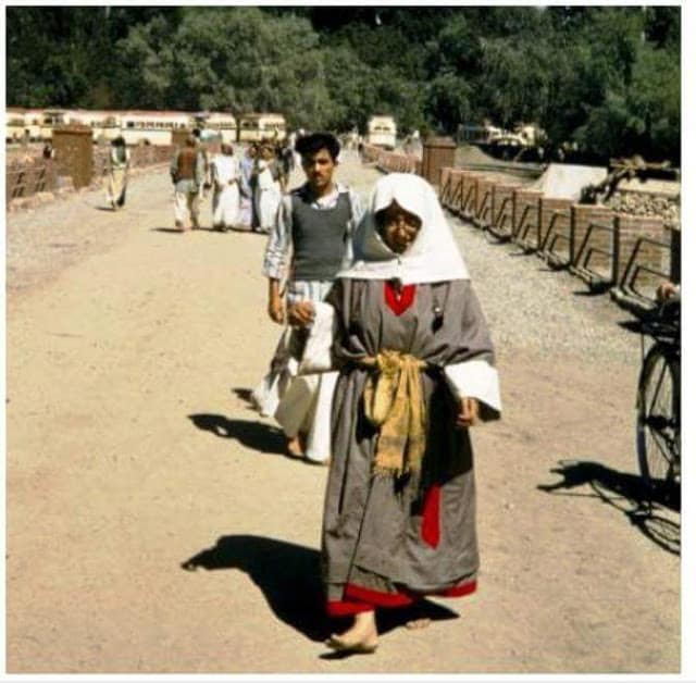
The Mughals who were not numerous were recorded to have Kram names like “Mir” (a corruption of “Mirza”), “Beg”, “Bandi”, “Bach” and “Ashaye”. Finally, it was recorded that the Pathans “who are more numerous than the Mughals, … are found chiefly in the south-west of the valley, where Pathan colonies have from time to time been found. The most interesting of these colonies is that of Kuki-Khel Afridis at Dranghaihama, who retain all the old customs and speak Pashtu.”

Among the main tribes of Muslims in the princely state are the Butts, Dar, Lone, Jat, Gujjar, Rajput, Sudhan and Khatri. A small number of Butts, Dar and Lone use the title Khawaja and the Khatri use the title Shaikh the Gujjar use the title Chaudhary. All these tribes are indigenous to the princely state which converted to Islam from Hinduism during its arrival in the region.
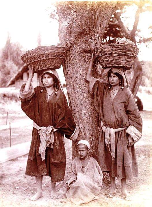
The Hindus were found mainly in Jammu, where they constituted a little less than 60% of the population. In the Kashmir Valley, the Hindus represented “524 in every 10,000 of the population (i.e. 5.24%), and in the frontier wazarats of Ladakh and Gilgit only 94 out of every 10,000 persons (0.94%).”
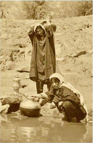
In the same Census of 1901, in the Kashmir Valley, the total population was recorded to be 1,157,394, of which the Muslim population was 1,083,766, or 93.6% and the Hindu population 60,641. Among the Hindus of Jammu province, who numbered 626,177 (or 90.87% of the Hindu population of the princely state), the most important castes recorded in the census were “Brahmans (186,000), the Rajputs (167,000), the Khattris (48,000) and the Thakkars (93,000).”
In the 1911 Census of the British Indian Empire, the total population of Kashmir and Jammu had increased to 3,158,126. Of these, 2,398,320 (75.94%) were Muslims, 696,830 (22.06%) Hindus, 31,658 (1%) Sikhs, and 36,512 (1.16%) Buddhists. In the last census of British India in 1941, the total population of Kashmir and Jammu (which as a result of the second world war, was estimated from the 1931 census) was 3,945,000. Of these, the total Muslim population was 2,997,000 (75.97%), the Hindu population was 808,000 (20.48%), and the Sikh 55,000 (1.39%).
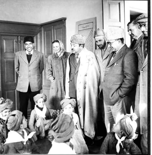
The Kashmiri Pandits, the only Hindus of the Kashmir valley, who had stably constituted approximately 4 to 5% of the population of the valley during Dogra rule (1846–1947), and 20% of whom had left the Kashmir valley by 1950, began to leave in much greater numbers in the 1990s.

According to a number of authors, approximately 100,000 of the total Kashmiri Pandit population of 140,000 left the valley during that decade. Other authors have suggested a higher figure for the exodus, ranging from the entire population of over 150 to 190 thousand (1.5 to 190,000) of a total Pandit population of 200 thousand (200,000) to a number as high as 300 thousand (300,000).
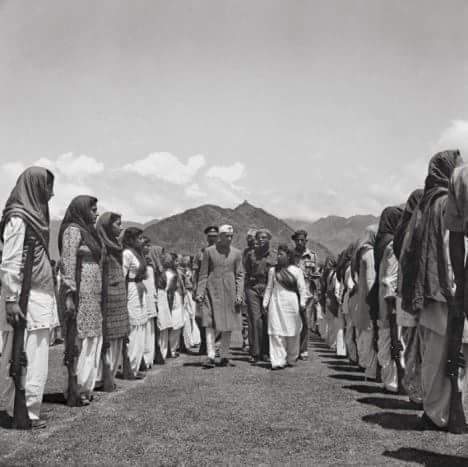
Kashmiri cuisine includes dum aloo (boiled potatoes with heavy amounts of spice), tzaman (a solid cottage cheese), rogan josh (lamb cooked in heavy spices), yakhiyn (lamb cooked in curd with mild spices), hakh (a spinach-like leaf), rista-gushtaba (minced meat balls in tomato and curd curry), danival korme, and the signature rice which is particular to Asian cultures.
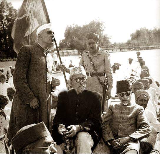
The traditional wazwan feast involves cooking meat or vegetables, usually mutton, in several different ways. Alcohol is strictly prohibited in most places.

There are two styles of making tea in the region: Noon Chai, or salt tea, which is pink in colour (known as chinen posh rang or peach flower colour) and popular with locals; and kahwah, a tea for festive occasions, made with saffron and spices (cardamom, cinamon, sugar, noon chai leaves), and black tea.
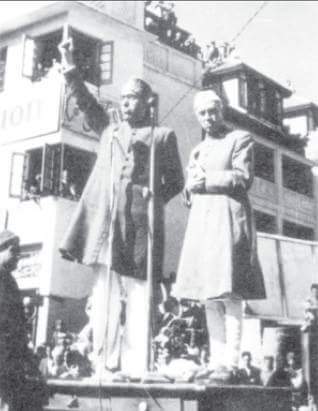
Kashmir’s economy is centred around agriculture. Traditionally the staple crop of the valley was rice, which formed the chief food of the people. In addition, Indian corn, wheat, barley and oats were also grown. Given its temperate climate, it is suited for crops like asparagus, artichoke, seakale, broad beans, scarlet runners, beetroot, cauliflower and cabbage. Fruit trees are common in the valley, and the cultivated orchards yield pears, apples, peaches, and cherries. The chief trees are deodar, firs and pines, chenar or plane, maple, birch and walnut, apple, and cherry.

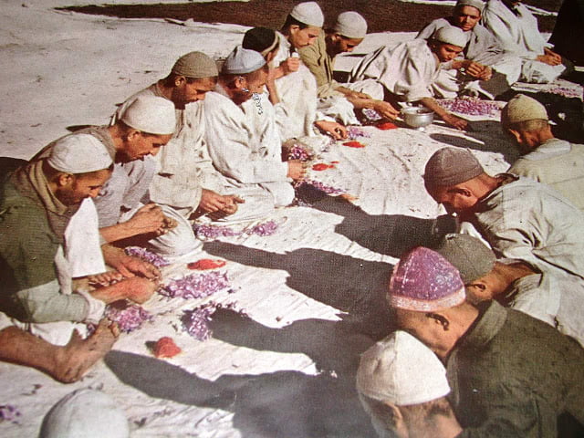
Historically, Kashmir became known worldwide when Cashmere wool was exported to other regions and nations (exports have ceased due to decreased abundance of the cashmere goat and increased competition from China). Kashmiris are well adept at knitting and making Pashmina shawls, silk carpets, rugs, kurtas, and pottery. Saffron, too, is grown in Kashmir.
Efforts are on to export the naturally grown fruits and vegetables as organic foods mainly to the Middle East. Srinagar is known for its silver-work, papier mache, wood-carving, and the weaving of silk.
The economy was badly damaged by the 2005 Kashmir earthquake which, as of 8 October 2005, resulted in over 70,000 deaths in the Pakistan-controlled part of Kashmir and around 1,500 deaths in Indian controlled Kashmir.
The Indian-administered portion of Kashmir is believed to have potentially rich rocks containing hydrocarbon reserves.
Disclaimer: The text in this article has been reproduced from Wikipedia.org
Follow Us
The Kashmir Pulse is now on Google News. Subscribe our Telegram channel and Follow our WhatsApp channel for timely news updates!


